For this project, I conducted research to identify the key challenges people face during natural disasters and developed an app concept that aimed to provide users with essential resources, real-time updates, and communication tools to help them navigate through emergencies.

User Research
Limited Access to Information during Disasters: Users may encounter difficulties accessing timely and accurate information during a disaster event, such as an earthquake or wildfire. This could include challenges in finding out about evacuation orders, shelter locations, or safety procedures.
Communication Breakdowns with Loved Ones: During emergencies, communication networks may become overloaded or disrupted, making it hard for users to connect with their friends and family to ensure their safety and well-being.
Lack of Preparedness Resources: Some users may not have adequate knowledge or resources to prepare for disasters beforehand, such as creating an emergency plan or assembling a disaster kit. This lack of preparedness could leave them vulnerable and unsure of what to do in a crisis situation.

EMPAthy map notes
I created an empathy map to better understand the needs and pain points of users during natural disasters for the BC Disaster Relief App. The map was divided into four key areas: Says, Thinks, Does, and Feels. This approach helped me gain insights into how users react and behave in crisis situations, what their emotional states are, and how they interact with the app’s features.
Says: The concerns and needs users express, such as asking for assistance or help during an emergency.
Thinks: The mental state of users, focusing on their thoughts surrounding safety, location, and communication.
Does: The actions users take, such as searching for resources, emergency help, or tracking loved ones.
Feels: The emotional responses users experience, such as anxiety, stress, or relief when they access emergency information.

USER FLOW


Main Functionalities of BC Disaster Relief App
The BC Disaster Relief App is designed to be a reliable and comprehensive tool for users during natural disasters. Its main functionalities are aimed at ensuring users stay connected, informed, and safe, even in critical situations:
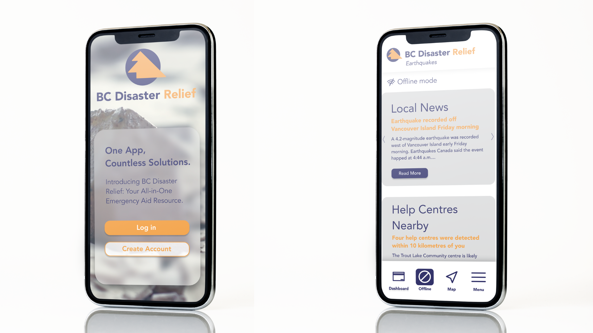
Offline Mode: The app continues to function without an internet connection, offering real-time updates on local disasters, and identifying nearby help centers. This ensures that users can access vital information, regardless of connectivity issues.
Maps & Navigation: The app includes an interactive map that helps users locate emergency help centres, resources, and safety information. Additionally, users can track the location of their contacts who are also using the app, providing reassurance and peace of mind during emergencies.
Well-Being Tools: Users can store medical ID cards within the app for quick access in case of an emergency. The app also features a low-power mode, helping to conserve battery life during critical moments when power might be limited.
User-Centred Design: With a clean, intuitive interface, the app is designed for ease of use, even under stress. All essential features are easily accessible, ensuring that users can quickly navigate the app during an emergency.
These functionalities were developed to address both the practical and emotional needs of users, ensuring the app remains a reliable lifeline during crises.

